On our way to Crater Lake today, we made a little stop 10 miles from our RV park.
The upper Rogue River natural bridge. Enjoy!
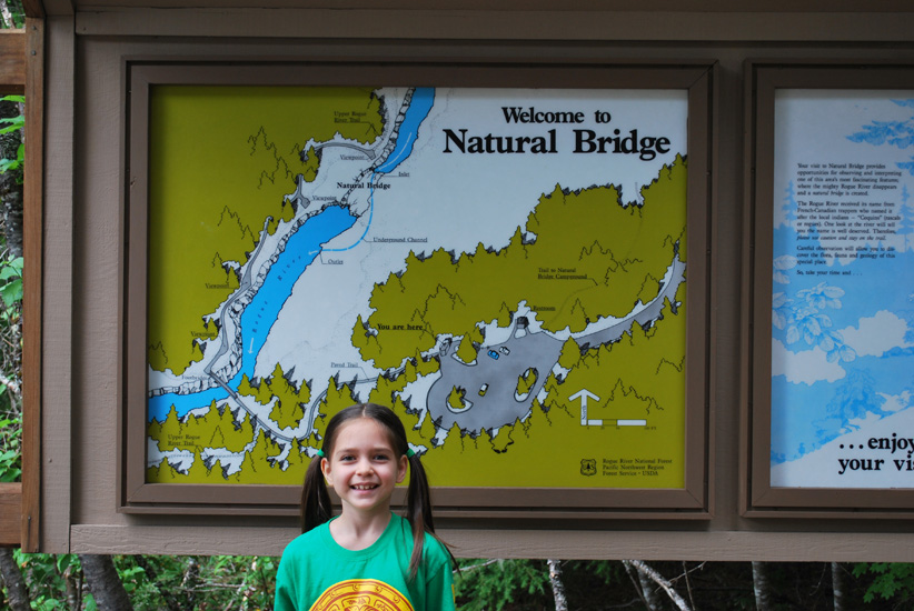
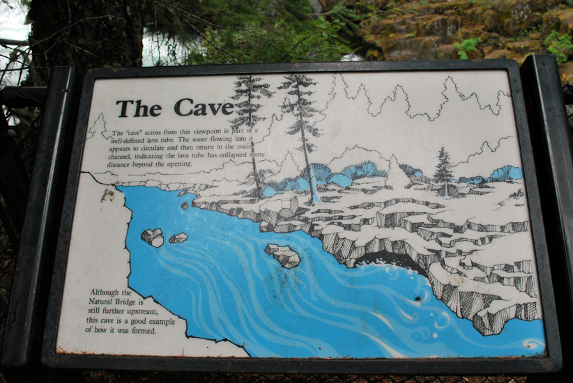
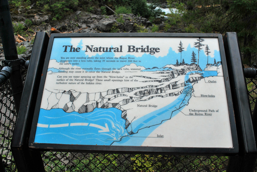
Isabel standing by the map of the area.
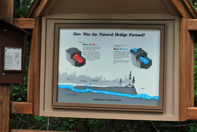
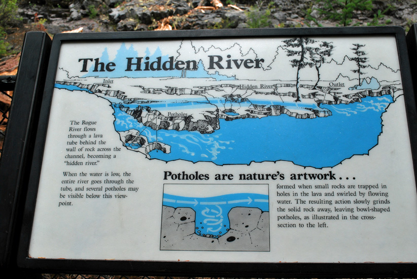
This sign states how the bridge was formed with lava and water.
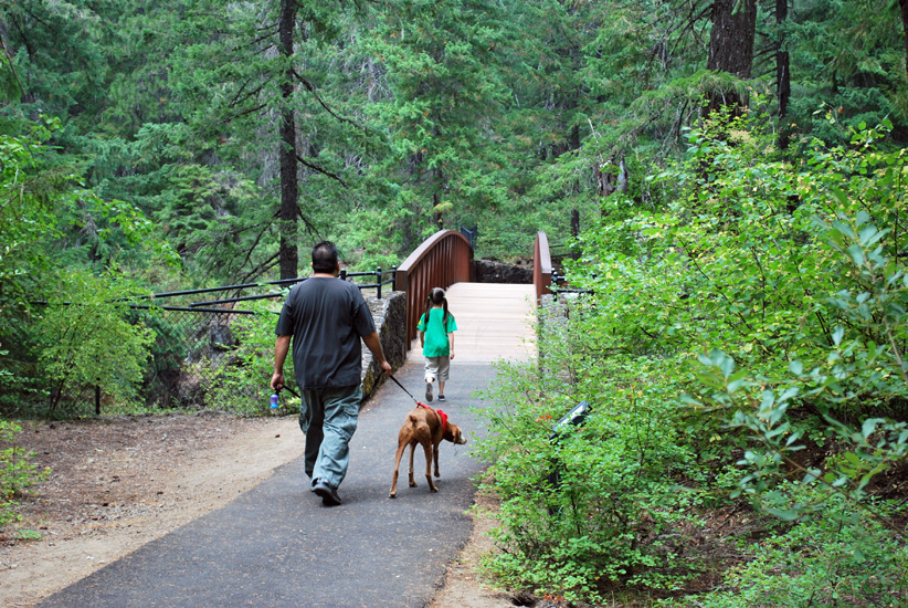
Heading to the natural bridge but first we have to cross a not-so-natural bridge.
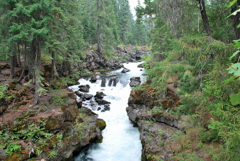
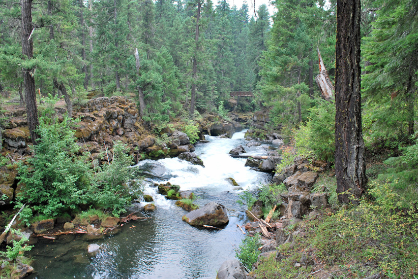
Looking north up the Rogue river on the not-so-natural bridge.
The mix of lava and forest is just so beautiful.
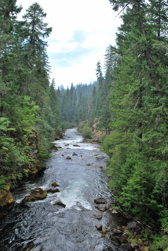
Looking south down the Rogue river on the not-so-natural bridge.
Gorgeous!
The “cave”, which appears to go back into the rock a ways but the water does come back out.
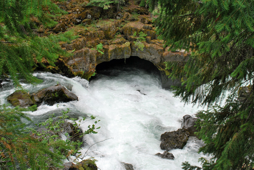
The “cave” along the Rogue river natural bridge.
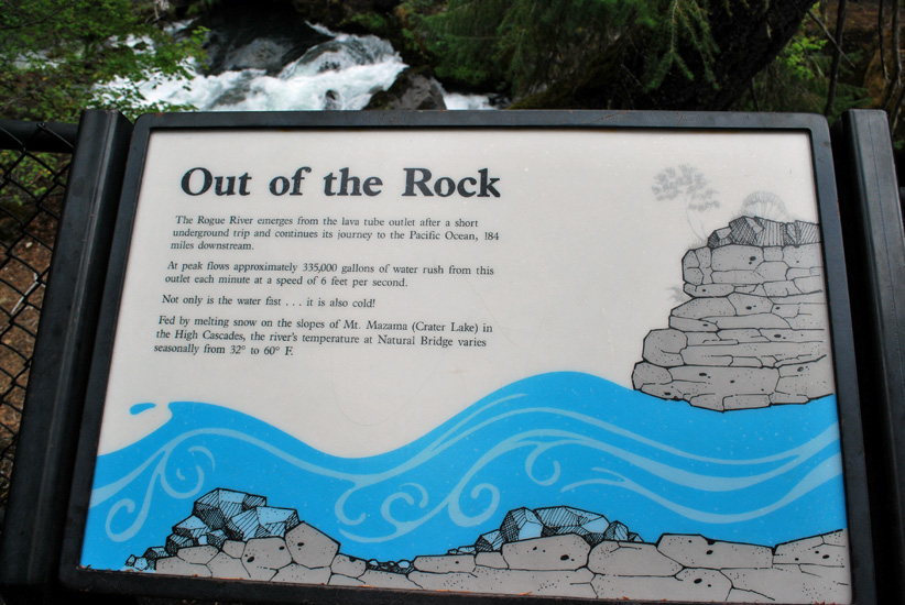
“Out of the Rock” the Rogue river emerges from the natural bridge before heading
to the Pacific Ocean 184 miles away.
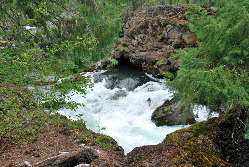
The water shoots out FAST here at the end of the bridge.
At peak flows approximately 335,000 gallons of water rush out each minute at speeds of 6 feet per second! Wow! The temperature in the river is cold too, varying seasonally from 32 ° to 60° Fahrenheit.
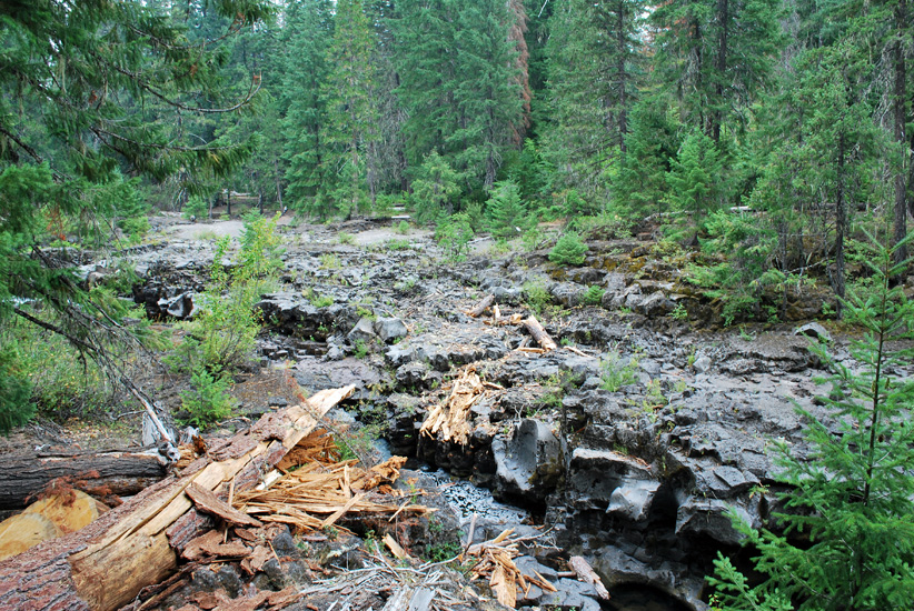
The “hidden river”.
When the water levels are low the whole river goes through the bridge.
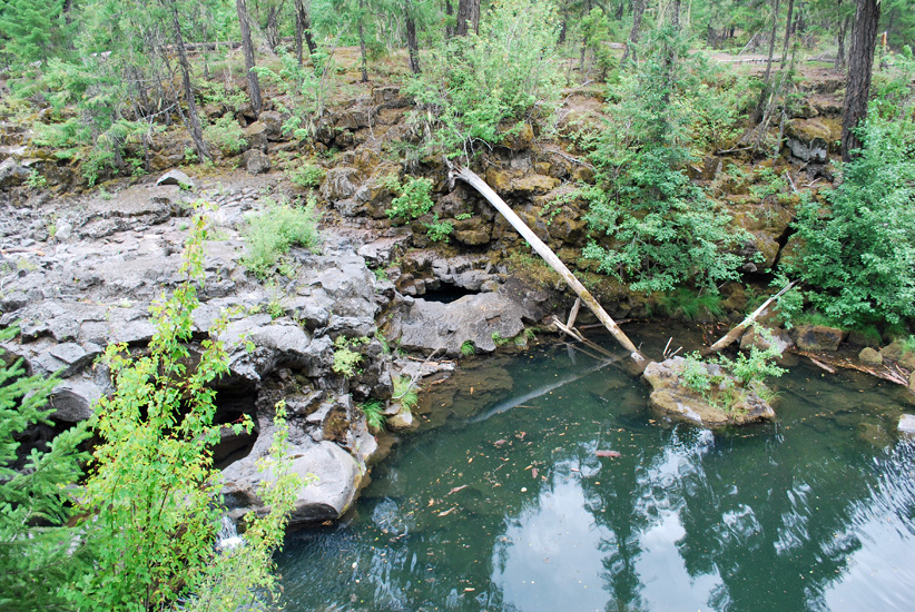
Looking north upstream just below the natural bridge inlet.
In seasons of heavy river flow this top part of the natural bridge would be under water.
When the water levels are low, “potholes” can be seen.
(to the left and right out front)
Looking south toward the not-so-natural bridge.
So pretty.
The natural bridge inlet is just below us!
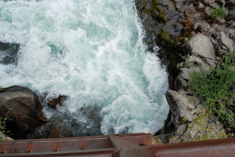
A look over the railing and all you see is water!
Very cool.